| Ownership: | 100% |
| Stage: | Highly Prospective; Drill Ready |
| Size: | 4,498 Ha |
| Location & Infrastructure |
Regional infrastructure to the properties is excellent with nearby year-round road access, readily available power and close proximity to Cameco’s Key Lake uranium processing facility. |
| Regional Significance |
These projects cover the southern extension of the graphitic conductive unit that hosts the Key Lake deposits. |
| Proximity to significant deposits |
Cameco’s former producing Key Lake mine, which extracted over 200 million pounds of uranium by open pit methods at an average grade of 2.3% U3O8 from 1983 to 1997, is located immediately to the north of the Highrock claim boundary. |
Outlook:
- Forum is targeting basement-hosted unconformity uranium, similar to Eagle Point in the Rabbit Lake camp and Arrow in the Patterson Lake corridor, which can extend down to 900m below the unconformity. The P-Patch, a basement hosted uranium deposit discovered by Forum’s Ken Wheatley, while with Uranerz in 1997, is present 10km to the north of Cameco’s Key Lake project. Last year, drilling encountered elevated levels of uranium, boron, vanadium and base metals along the 10km long graphitic conductor. It is the presence of these pathfinder minerals that potentially may lead to a similar basement-hosted uranium discovery in the vicinity.
Work Program for 2019
- Future work has been deferred until market conditions improve.
Historical Work
- A narrow ground gravity survey was completed over the immediate conductor area on the project, followed by an eight hole diamond drill program in 2016. The graphitic conductor was intersected in seven of the eight holes, with the strongest tectonics and alteration located in HR-07, the furtherest south of the program. A further 3 km of untested conductor lies to the south of this hole.
- Another ground gravity survey was completed in 2017 and identified several new areas of interest at the north end of the property, closest to the Key Lake deposits. The results of the 100m X 100m station density survey show several new gravity lows, interpreted to be caused by clay alteration systems that may be associated with uranium mineralization. An exceptionally large gravity low coupled with the significant 4 km north-south EM conductor on the north end of the property near the Cameco/Orano Key Lake property boundary remain untested.
Maps & Figures
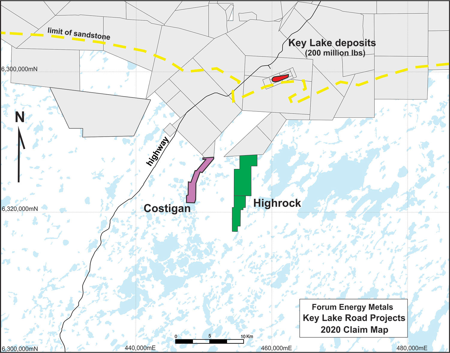
Figure 1: Highrock Location Map
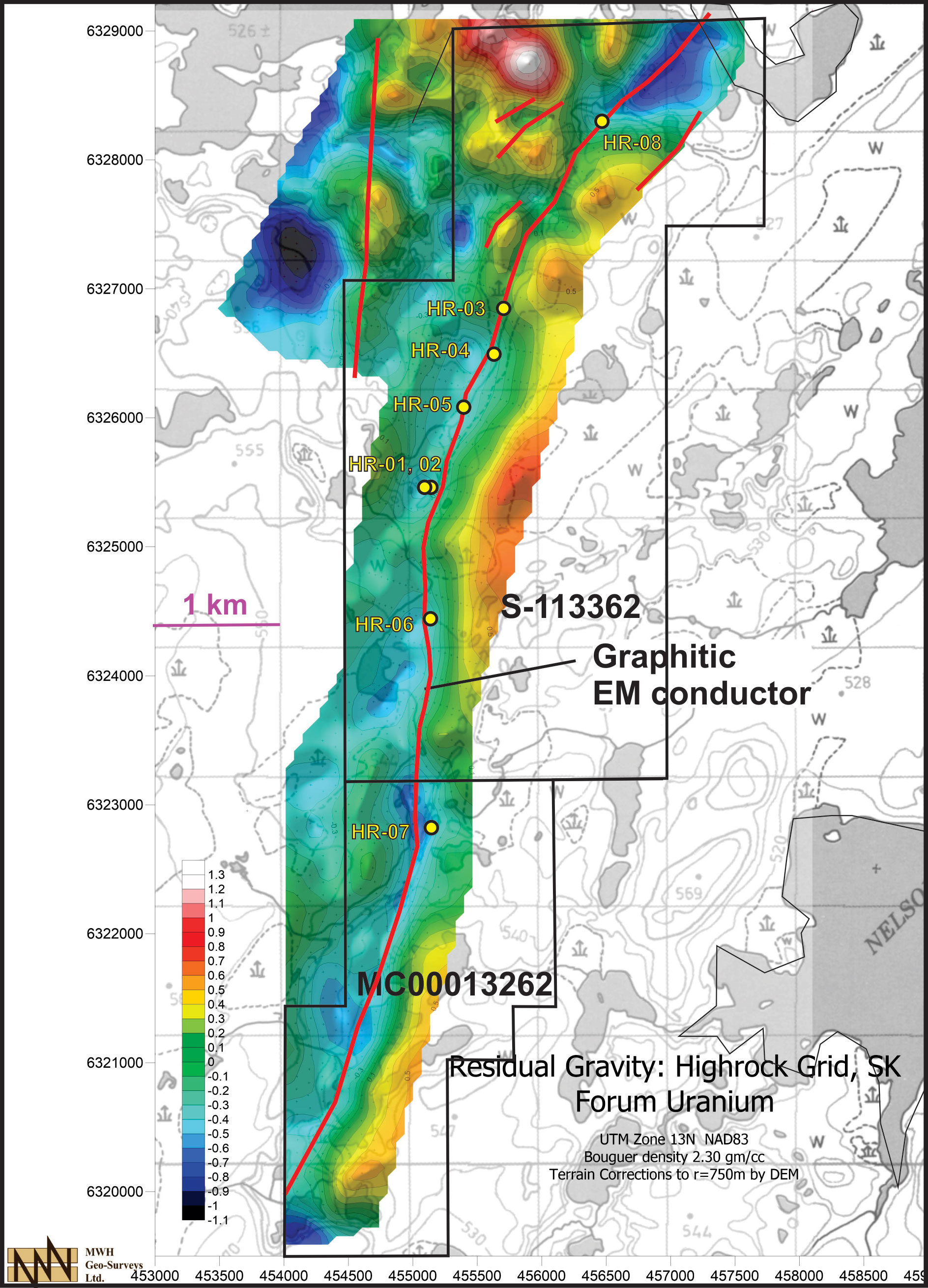
Figure 2: Residual Gravity on the Highrock Project. Gravity highs are red, gravity lows are blue. The EM conductors are shown as red lines, yellow dots are Forum drill holes from earlier reconnaissance drilling completed in 2016. The large area of coverage on the north end of the project was covered by the recently completed 2017 ground gravity survey.